Hurricane Flood Risk in NYC
The effects of Hurricane Sandy revealed New York City’s vulnerability to flooding from storm surge during extreme weather events. Understanding where the city’s most vulnerable populations are located, and how they will be impacted by flooding from storms of different strengths, can help the city plan to protect its residents.
Note: Areas and populations estimated to be impacted may be overstated due to data limitations. Data Sources: 2010 Census, US Department of Health and Human Services Health Resources and Services Administration, National Oceanic and Atmospheric Association, and New York Department of Environmental Conservation. Javascript coding support provided by Eric Field and Morgan Bird.
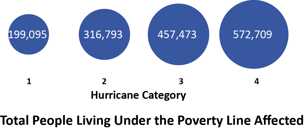
A range of variables make residents of New York City more vulnerable to coastal storm flooding and its aftermath than others. The elderly, people living under the poverty line, medically underserved populations, those living in housing that predates current building codes, and those living near contaminated lands face increased risks during extreme weather events. Combining these factors factors into a single combined risk metric is useful in identifying priority areas for planning. Coastal areas of northwest Brooklyn and southwest Bronx have particularly high risk factors.
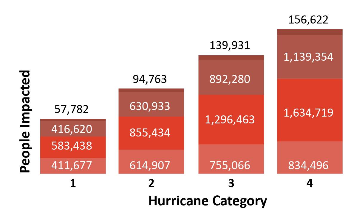
Residents living under the poverty line have fewer resources to dedicate to adequate pre-storm preparation or evacation, as well as limited resources to use to address damaged assets once a storm has passed. Approximately 13 to 15 percent of New Yorkers affected by each category of storm live below the poverty line. The highest numbers of poor live in along the Harlem River and in parts of each of the five boroughs.
Residents need not only physical access to emergency and health services before, during and after extreme storm events, but also the resources to gain access to those services. US Department of Health and Human Services Health Resources designates Medically Underserved Areas (MUAs) as areas “in which residents have a shortage of personal health services.” and “Medically Underserved Populations (MUPs) as ”groups of persons who face economic, cultural or linguistic barriers to health care.” Approximately 30 percent of New Yorkers living in areas that would be affected by storm surge fall within one of these two groups.
For more information on medically underserved populations, visit the Health Resources and Services Administration website.